- First detailed maps of the underside of Antarctic ice-shelf fills major blind-spot in ice-sheet understanding.
- Mapping of swirls and scoops in the ice raises questions about ice-sheet melt, which has implications for future seal-level rise.
- The mapping will help interpret and calibrate satellite data to better track ice-sheet melt.
Clues to future sea level rise have been revealed by the first detailed maps of the underside of a floating ice shelf in Antarctica.
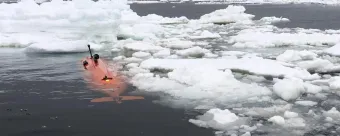
The maps, showing swirls and scoops on the underside of the huge Dotson Ice Shelf, in West Antarctica, were gathered using the University of Gothenburg’s autonomous underwater vehicle Ran.
Ran was sent on a 1,000km-long mission, travelling back and forth for 27 days under 350m of thick ice during an international research expedition supported by National Oceanography Centre (NOC) scientist Dr Tiago Segabinazzi Dotto.
Using advanced multibeam sonar technology, pointing upwards, the vehicle was able to gather the very first detailed maps of the underside of a glacier.
"Being able to map the underside of the glacier in this way fills in what has otherwise been a major blind spot in our understanding of this part of the West Antarctic ice sheet, the melting of which could have a potentially large impact on future sea level rise,” says Dr Dotto, who was on the 2020 expedition to the Dotson Ice Shelf while working at the University of East Anglia, and who processed some of the hydrographic data involved.
“We will continue to study these processes at the NOC to help inform our understanding of how fast ice shelves will melt in the future.”
Tracking ice-sheet melt
The Dotson Ice Shelf is part of the West Antarctic ice sheet. It is thought it could have a potentially large impact on future sea level rise due to its size and location.
Thanks to the imagery from the underside of the ice shelf, scientists will be better able to interpret and calibrate the data they get from the satellites that helps them track ice-sheet melt.
"We have previously used satellite data and ice cores to observe how ice shelves change over time,” explains Anna Wåhlin, Professor of Oceanography at the University of Gothenburg, lead author on a paper published on the research in Science Advances. “By navigating the submersible into the cavity, we were able to get high resolution maps of the ice underside. It’s a bit like seeing the back of the moon for the first time.”
Some of the findings were as expected. For example, the glacier melts faster where strong underwater currents erode its base. Using the submersible, scientists were able to measure the currents below the glacier for the first time and prove why the western part of Dotson Ice Shelf melts so fast. They also saw evidence of very high melt at vertical fractures that extend through the glacier.
But the researchers also saw new patterns on the glacier base that raised questions. The base is not smooth – there is a peak and valley ice-scape with plateaus and formations resembling sand dunes. The researchers hypothesise that these may have been formed by flowing water under the influence of Earth’s rotation.
Better models needed to predict ice-shelf melt
Dr Karen Alley, a glaciologist from the University of Manitoba and co-author of the study, says, “The maps that Ran produced represent a huge progress in our understanding of Antarctica’s ice shelves. We’ve had hints of how complex ice-shelf bases are, but Ran uncovered a more extensive and complete picture than ever before.”
“The mapping has given us new data that we need to look at more closely,” adds Professor Wåhlin. “It is clear that many previous assumptions about melting of glacier undersides are falling short. Current models cannot explain the complex patterns we see. But with this method, we have a better chance of finding the answers.
“Better models are needed to predict how fast the ice shelves will melt in the future. It is exciting when oceanographers and glaciologists work together, combining remote sensing with oceanographic field data. This is needed to understand the glaciological changes taking place – the driving force is in the ocean.
&lqduo;There are not many uncharted areas left on Earth. To see Ran disappear into the dark, unknown depths below the ice, executing her tasks for over 24 hours without communication, is of course daunting. Experience from over 40 missions below ice gave us confidence but, in the end, the challenging environment beat us.”
Under-ice operational challenges
The field work for this study was conducted in 2022. In January 2024, the group returned with Ran to Dotson Ice Shelf to repeat the surveys, hoping to document changes.
They were only able to repeat one dive below Dotson ice shelf before Ran disappeared without a trace.
“Although we got valuable data back, we did not get all we had hoped for,” says Professor Wåhlin. “These scientific advances were made possible thanks to the unique submersible that Ran was. This research is needed to understand the future of Antarctica’s ice sheet, and we hope to be able to replace Ran and continue this important work.”
Read the full paper in Science Advances.
NOC’s polar research, across Antarctica and the Arctic, includes investigating ocean circulation, ice dynamics and the impacts of climate change on polar environments through field expeditions, remote monitoring and climate modelling.
This is to help understand how polar ice sheets and glaciers contribute to sea-level rise, changes in polar marine ecosystems and the role of polar regions in global climate regulation.
Notes to editors
For press enquiries, please contact: communications@noc.ac.uk
About NOC
NOC is the UK’s leading institution for integrated coastal and deep ocean research. NOC undertakes and facilitates world-class agenda-setting scientific research and technology development to understand the global ocean by solving challenging multidisciplinary, large scale, long-term marine science problems to underpin international and UK public policy, business and societal outcomes. NOC is a company limited by guarantee set up under the law of England and Wales (11444362) and registered as a charity (1185265).
NOC operates the Royal Research Ships James Cook and Discovery and develops technology for coastal and deep ocean research. Working with its partners NOC provides long-term marine science capability including: sustained ocean observations, mapping and surveying; data management and scientific research and advice.
Among the resources that NOC provides on behalf of the UK are the British Oceanographic Data Centre (BODC), the Marine Autonomous and Robotic Systems (MARS) facility, the National Marine Equipment Pool (NMEP), the National Tide and Sea Level Facility (NTSLF), the Permanent Service for Mean Sea Level (PSMSL) and British Ocean Sediment Core Research Facility (BOSCORF).