Gliders are a type of robotic underwater vehicle used for measuring oceanographic parameters such as chlorophyll levels, temperature and salinity, which are then transmitted back to the shore. They are very effective tools for gathering data from the ocean and carry a great variety of instruments.
Find out more about the gliders, what they are capable of doing, and how they are being used.
Find out more about the National Marine Equipment Pool
About Gliders
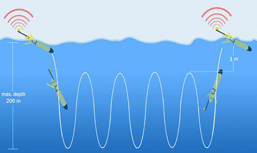
A glider uses an internal pump to change its buoyancy, enabling it to move up and down in the water, where as conventional robotic vehicles or Autonomous Underwater Vehicles (AUVs, such as Autosub) are propeller-driven. The movement of internal weights back and forth enables the glider to angle itself to dive or climb in the water column. Like an aerial glider moving vertically through the air, underwater gliders use the lift generated by the wings moving through the water to convert vertical force into forward motion. Gliders are fitted with an inbuilt compass, which they use to steer a course. Gliders move very slowly, usually at less than a mile per hour, but can maintain this speed for months on end.
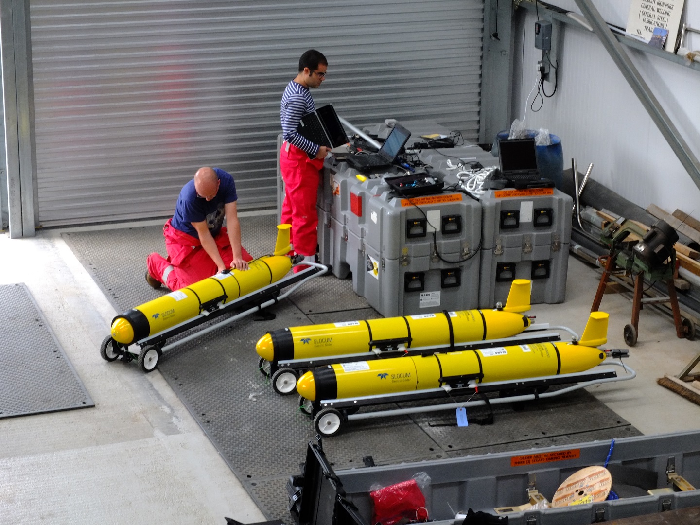
Gliders have been around for around 20 years in one form or another, designed and built by universities and research institutes. Today they are made and sold commercially, mainly by companies in the United States. The NOC glider fleet has gliders from two manufacturers: Slocum gliders from Teledyne Webb Research Corporation, and Seagliders from Kongsberg Underwater Technology Inc.

To move up and down, the glider does not change its mass, but by pumping a fluid (oil in this case) from an internal reservoir to an external flexible bladder, so it can increase its volume. The density of a glider depends on both its mass and its volume; by pumping oil in and out of the bladder the glider is able to make itself alternately denser and lighter than the surrounding water – the glider can sink to a pre-programmed depth then float back to the surface.
Technology
Glider missions can run for many months with directions being sent remotely via two-way satellite communications (Iridium) link. They use little energy and so are inexpensive to operate compared to using traditional methods. Gliders sensors have very low-power requirements, typically consuming an average power of less than one Watt.

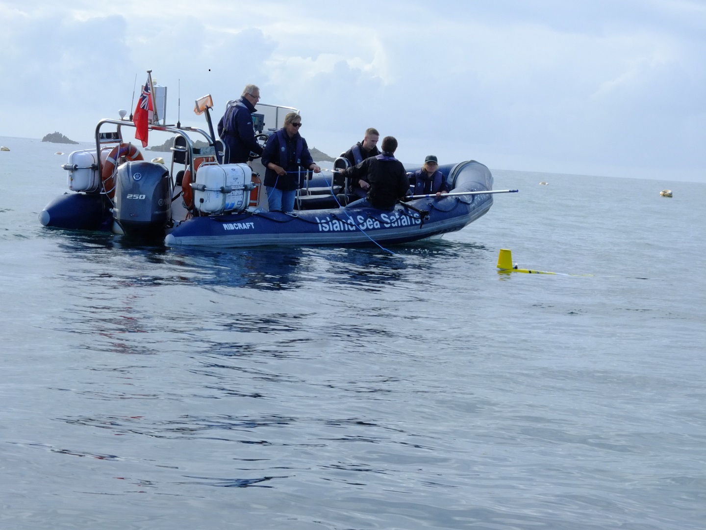
With a typical length of 2m and weight of around 65kg, gliders do not always need to be deployed or recovered from the deck of a research ship, which makes glider missions cheaper to run and more versatile to schedule. Many glider missions are started and ended using two people and a fast RIB, piloting the glider close to the shore at the start or end of its mission. Where ship deployment or recovery is necessary, it usually only takes only a few hours of ship time.
In principle, buoyancy engines are neither more nor less efficient than a motor and propeller, but the fact that gliders travel very slowly means they consume little energy in propelling themselves. A Seaglider or a Slocum glider diving to 1,000 metres consumes about 65 Watts from its batteries, for about two minutes, when it pumps some oil to the external bladder and returns to the surface. This pumping of oil to the external bladder is the biggest power drain on the glider’s battery, although this process is only carried out once every few hours. When the glider reaches the surface, a small valve is opened and the partial vacuum inside the main hull sucks the oil from the bladder back into the reservoir. Another motor moves one of the heavy batteries back and forth a small distance to angle the nose up or down, which enables the glider to see-saw between the ocean surface and its maximum depth, moving slowly forwards with each vertical movement. This type of glider cannot fly level unless an auxiliary propeller is fitted, which can be done with the Slocum, although both Slocums and Seagliders can stop and drift at depth for some types of measurement.
Gliders can use conventional alkaline batteries for short missions and some are now using rechargeable lithium batteries. For longer missions, gliders need the power density of a primary lithium battery pack. With a small sensor load, i.e., temperature and salinity against depth, a glider is able to last six to nine months at sea. Sensors that use luminescence to measure, e.g., relative chlorophyll density or oxygen, will use more power and restrict missions to three months. Biofouling in the form of barnacles and algae will slow the glider and take any optical sensor readings out of calibration. Cold water such as over the Antarctic continental shelf also reduces mission duration as all batteries have reduced capacity as the temperature approaches freezing.
In order to transmit data back to land, the glider establishes communications with the shore station over an Iridium satellite link each time it surfaces. This allows the pilot to monitor progress, check the state of critical systems such as battery level and make changes to the mission course. The glider sends back data from its sensors, which we can then plot, almost in real time. In order to follow the mission course, the glider takes a GPS fix on each surfacing and recalculates the course to its next waypoint.
Capability
Standard sensors usually fitted to gliders in the NOC fleet include conductivity, temperature, depth (CTD), a fluorescence sensor measuring chlorophyll, optical backscatter and colour of water and an oxygen optode. They can usually carry one other sensor, such as a fish-finding echo-sounder or a light level sensor (PAR sensor).
On certain expeditions, gliders have also been fitted with larger, more power-hungry sensors. Because they are not designed for this, the battery consumption is increased and mission length is decreased, often to only a few weeks. The slow and gentle way a glider flies enables it to measure a profile from 1,000m to within a couple of metres of the surface, without disturbing the structure of what it is measuring, as most other vehicles or methods would.
The great strength of a glider is the ability to build up a picture of the structure of the ocean in both space and time, what is called 4-D sampling, giving us fine detail over a wide area. They are good at mapping the position of oceanic fronts, plotting the change in the thermocline where the surface water meets the deep oceanic water and many other slowly changing features that are important in the calculations behind oceanic global warming models.
Expeditions

Current expeditions
To keep up to date with current glider missions and to see the global position of each of the vehicles in our fleet please visit the Marine Autonomous Robotic Systems website.