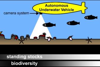
In an article published recently in Conservation Biology, National Oceanography Centre (NOC) scientists demonstrate that seafloor photographic surveys by robot-subs can offer a practical solution to the growing need to monitor biodiversity over a range of habitats within marine protected areas (MPAs).
MPAs are a key tool for maintaining and restoring biodiversity. They currently cover over 27 million km2 of the global ocean and require routine monitoring to record the effectiveness of marine conservation measures. This creates a need for a standard, efficient, and robust method for monitoring MPAs, which is broadly applicable over a range of marine environments and habitats.
As part of this research, NOC scientists analysed seafloor images taken by the NOC’s robot-sub Autosub6000 as it surveyed an area of the Greater Haig Fras MPA in the Celtic Sea in 2012.
Noëlie Benoist, the lead author from the NOC and the University of Southampton, said, “We studied thousands of seafloor photos to make a record of any marine life over one centimetre in body size, including fish, sponges and starfish. We also classified seafloor habitat type, whether it was sand, rock, or a mix of the two.”
The study highlights the need for common field- and data-analysis methods that can operate across multiple seafloor habitats types. This will be particularly important for the routine monitoring of MPAs, as well as studying how seafloor ecosystems change in response to human activities and climate change. This study is part of the NOC’s ongoing research at the Greater Haig Fras site, which is an ideal test area for repeat monitoring and MPA conservation assessment.
Noëlie commented, “Efficiently acquiring ecological data is key to basic biological research, monitoring changes in biodiversity, and in the development of effective conservation programmes. Our results show that robot-subs like Autosub6000 can produce accurately navigated and high-resolution image data that are essential for seafloor ecological research and practical marine conservation plans. It is important that we consider and test new marine environmental monitoring solutions that have the potential to generate ecologically relevant information on our changing oceans”.
The work at Haig Fras was supported in part by the Department for Environment, Food and Rural Affairs (Defra) and a collaborative partnership with the Centre for Environment, Fisheries and Aquaculture Science (Cefas). This ongoing study is a contribution to the NERC-funded Climate Linked Atlantic Section Science (CLASS) project.

